Advertisement
Latest Version (Download)Table of Contents
Advertisement
Information
| Package | com.huntstand.core |
| Version | 5.5 |
| Date Updated | 2021-05-06 |
| Size | 8.71 MB |
| Installs | 1.1K+ |
| Categories | Applications, Sports |
Screenshots
Description
HuntStand, dünyada 1. ücretsiz av uygulaması. Haritalama, Hava Durumu, İzcilik.
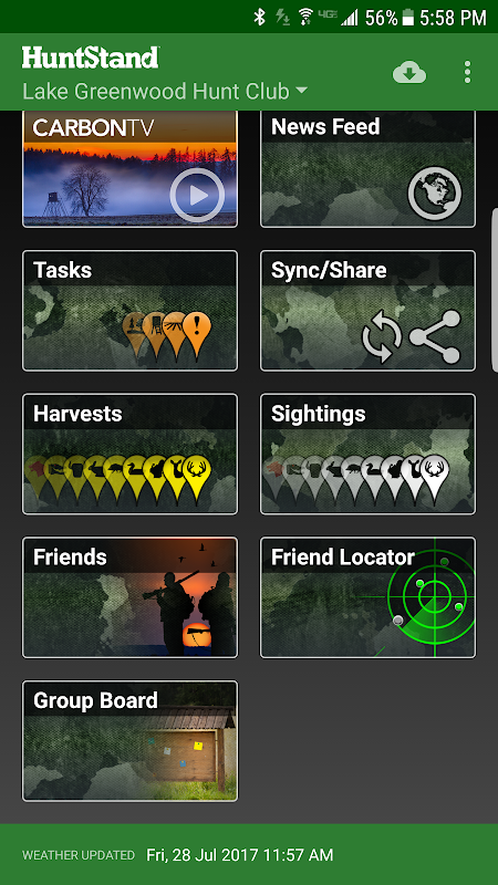
HuntStand, the #1 free hunting app in the world, is the only hunting and land management app you will ever need. This revolutionary app is packed with invaluable mapping, weather, tracking, and social features.
HuntStand was carefully designed to work in both online and offline environments. Using this app, you will have access to offline weather and maps of your hunt areas. You can edit your maps while out “in the field” then sync them with your HuntStand account.
Use our Harvest, Sightings, and Task logging features to understand your property like never before.
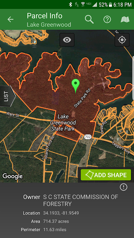
Access free property owner information and parcel boundary information for most of the country.
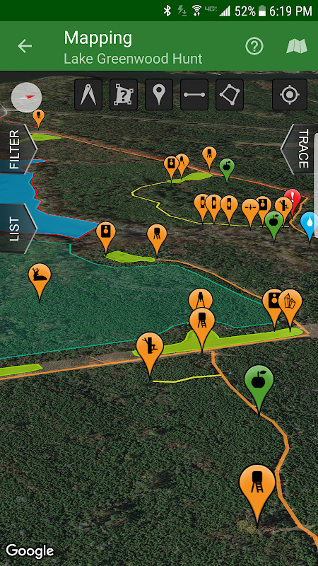
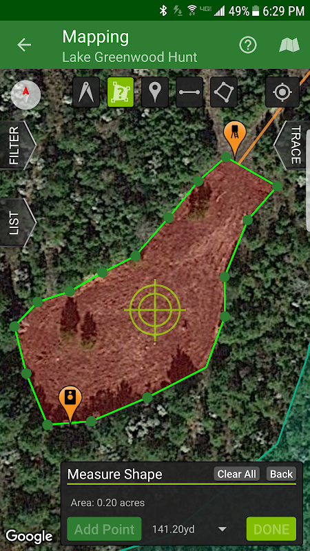
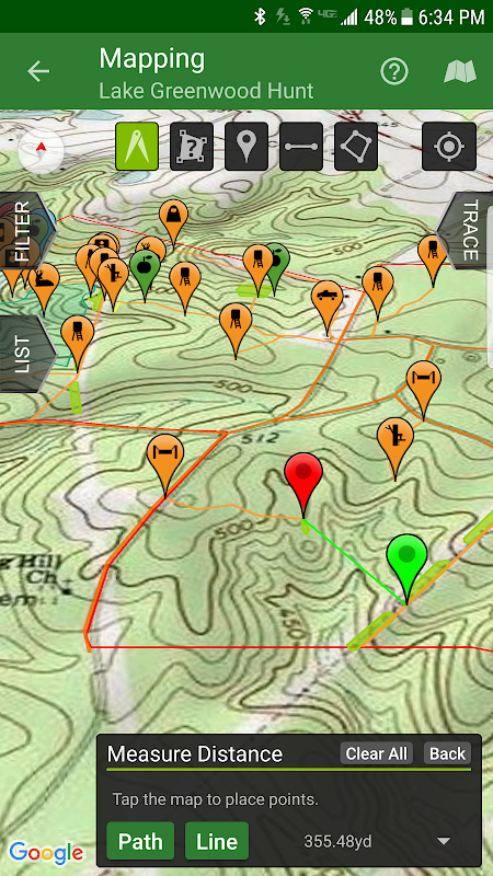
Fully map your property using 67 easily discernible custom icons, shapes, and lines including scouting marks, stands, property boundaries, food plots, ponds, roads, trails, and numerous other important objects of interest. Attach notes to your map objects and sort them by time and type.
View distance and area measurements using our advanced measurement tools. Our app will give you extremely accurate map-based distances in feet, meters, and yards and area measurements in acres.
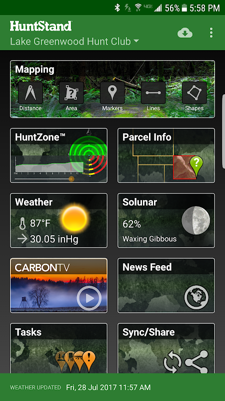
HuntStand's interface is simple, yet powerful, and puts many useful tools right at your fingertips.
Create an account and gain the ability to:
-Sync Hunting Area maps with HuntStand.com
-View and edit maps using ultra-advanced on-line mapping features
-Share maps with friends
-Create a personal profile
-Join group hunting areas (allowing you to share and edit maps with your hunting friends)
-View advanced statistics built from your personal harvest and sighting history
-Sync your maps with other devices (Computers, tablets, phones, including both Android and iOS)
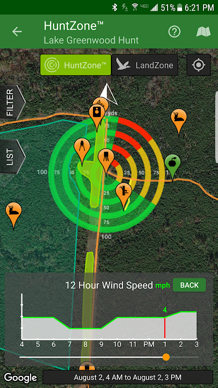
HuntStand features our revolutionary patent pending HuntZone technology. The HuntZone scent tool shows wind speed, direction, distance, and time in the most streamlined and efficient way possible. You can “slide” through wind forecasts and view the effects on your desired hunting area. The HuntZone tracks where your scent will be both at a specific time and throughout your hunt, allowing you to plan accordingly.
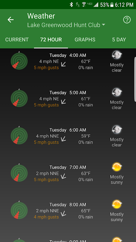
Have access to highly detailed weather and solunar information including a current weather page, (with useful charts) a 72 hour forecast, and a 5 day outlook.
HuntStand, powered by TerraStride, will revolutionize the way people hunt and operate in the outdoors.
HuntStand, dünyanın içerisinde 1 ücretsiz av uygulaması, hiç ihtiyacınız olacak tek avcılık ve arazi yönetimi uygulaması. Bu devrimci uygulama paha biçilmez haritalama, hava durumu, izleme ve sosyal özellikleri ile doludur.
HuntStand dikkatle hem çevrimiçi hem de çevrimdışı ortamlarda çalışmak üzere tasarlanmıştır. Bu uygulamayı kullanarak, çevrimdışı hava durumu ve av alanlarının haritalara erişimine sahip olacaktır. "Alanında" dışarı ardından HuntStand hesabı ile senkronize ederken haritalar düzenleyebilirsiniz.
Daha önce hiç olmadığı gibi özelliği anlamanız için Hasat, görüldüğüne ve Görev günlüğü özelliklerini kullanın.
Ülkenin en Erişim ücretsiz mülk sahibi bilgileri ve parsel sınır bilgiler.
Tam izcilik işaretleri, standları, mülkiyet sınırları, gıda araziler, göletler, yollar, yollar ve ilgi çok sayıda diğer önemli nesneler de dahil olmak üzere 67 kolayca fark edilebilir özel simgeler, şekiller ve çizgiler kullanarak mülkiyet haritası. harita nesnelere notlar iliştirmek ve zaman ve türüne göre bunları sıralamak.
Görünüm mesafesi ve gelişmiş ölçüm araçlarını kullanarak alan ölçümleri. Bizim app dönüm ayaklar, metre ve yarda ve alan ölçümleri size son derece hassas harita tabanlı mesafeler verecektir.
HuntStand arayüzü basit, ama güçlü ve sağ parmaklarınızın ucunda çok kullanışlı araçları koyar.
Bir hesap oluşturun ve yeteneğini kazandırmak:
-Sync Av Alanı HuntStand.com ile haritalar
Ultra-ileri on-line olarak haritalama özelliklerini kullanarak -View ve düzenleme haritaları
Arkadaşlarınızla -Share haritalar
kişisel bir profil -oluşturun
-Join Grup av alanları (Paylaşmak ve izin avcılık arkadaşlarınızla düzenleme haritaları)
Kişisel hasat ve nişan tarihinin inşa -View gelişmiş istatistik
(Android ve iOS de dahil olmak Bilgisayarlar, tablet, cep telefonları,) diğer cihazlarla haritaları -Sync
HuntStand bizim devrimci patent bekleyen HuntZone teknolojisine sahiptir. HuntZone koku aracı mümkün olan en akıcı ve verimli bir şekilde rüzgar hızı, yönü, mesafe ve zamanı gösterir. Sen rüzgar tahminleri aracılığıyla "slayt" ve istediğiniz avlanma alanı üzerindeki etkileri görebilirsiniz. kokun buna göre planlamak sağlayan belirli bir zamanda ve avı boyunca hem nerede olacak HuntZone izler.
oldukça detaylı hava ve (kullanışlı grafikler ile) güncel hava sayfasında, 72 saatlik tahmini ve 5 günlük görünüm de dahil olmak üzere solunar bilgilere erişebilir.
TerraStride tarafından desteklenmektedir HuntStand, yol insanlar avı devrim ve açık havada çalışacaktır.
What's New
- Now targeting Android 8.1
- Added a new Public Lands layer!
- The "Friends" feature has been fixed!
- Check out our new "Land For Sale" feature!
- The HuntZone feature should look pretty sharp now.
- "Show all" and "Hide all" added to the "Filter" available when Mapping for your convenience.
- Print your maps from HuntStand.com using a desktop browser!
- Feel free to write to [email protected] to report bugs and feature requests.
Latest Version (Download)
HuntStand 5.5Date Updated : 2021-05-06
Advertisement

