Advertisement
Latest Version (Download)Table of Contents
Advertisement
Information
| Package | org.railstotrails.traillink |
| Version | 2.5.5 |
| Date Updated | 2023-11-03 |
| Size | 58.94 MB |
| Installs | 323 |
| Categories | , |
Screenshots
Description
แผนที่เส้นทางที่ดีที่สุดสำหรับเส้นทางจักรยานเส้นทางเดินแผนที่ออฟไลน์และ GPS กลางแจ้ง
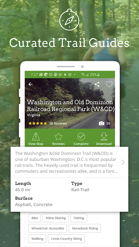
TrailLink is the ultimate trail guide with detailed offline maps! Explore the best bike trails, walking trails, running trails, dog-friendly trails and other outdoor activities. Download the best bike trail maps found anywhere plus view reviews, photos and generate driving directions to nearby trails using TrailLink.
TrailLink is provided by Rails-to-Trails Conservancy (RTC) and powered by RTC's expert trails database which offers unique trail-finder functionality for more than 37,000 miles of multi-use trails.
The TrailLink app offers in-app purchases for RTC's detailed offline bike trail maps which can now be downloaded for offline use in the TrailLink app to fully empower your next on-the-trail adventures! Take TrailLink with you and let Rails-to-Trails Conservancy be your expert guide out on the trail. Try it out today and register to get your first offline map for free!
Rails-to-Trails Conservancy's GIS mapping initiatives have produced more than 37,000 miles of highly accurate trail maps which include tens of thousands of amenity waypoints such as parking lots, trailheads, tunnels, restrooms, drinking fountains & much more — all available for download in the TrailLink app.
TrailLink will allow you to:
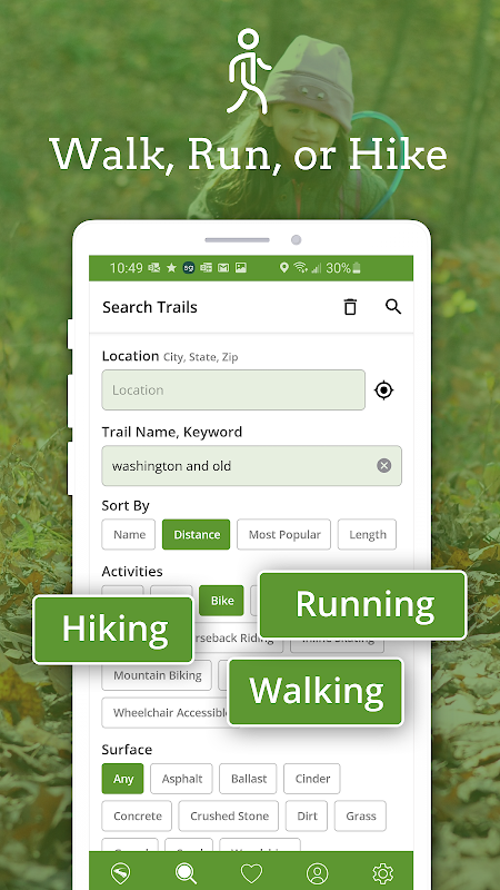
•Search for trails near you or by location
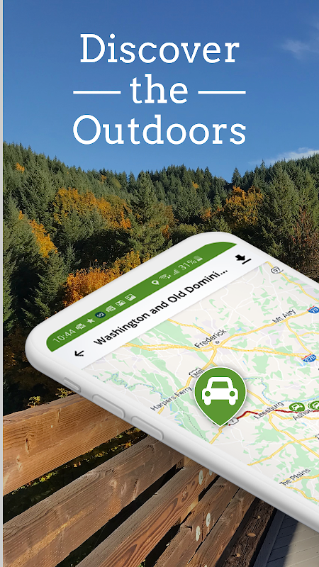
•Search for trails on the map
•Read RTC's expert trail descriptions
•Read and write trail reviews
•Save your trail favorites
•Upload trail photos
•Share trails with friends
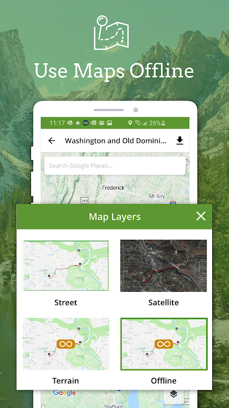
•Download RTC's trail maps for offline use
•See your location on the trail
•Find restrooms, parking & much more
•Sync your account with TrailLink.com
•Support the mission of Rails-to-Trails Conservancy!
Download TrailLink today and let RTC guide your way!
TrailLink เป็นคู่มือเส้นทางที่ดีที่สุดพร้อมแผนที่ออฟไลน์แบบละเอียด! สำรวจเส้นทางจักรยานที่ดีที่สุดเส้นทางเดินเส้นทางวิ่งเส้นทางเดินที่เป็นมิตรกับสุนัขและกิจกรรมกลางแจ้งอื่น ๆ ดาวน์โหลดแผนที่เส้นทางจักรยานที่ดีที่สุดที่พบได้ทุกที่พร้อมดูรีวิวภาพถ่ายและสร้างเส้นทางการขับขี่ไปยังเส้นทางใกล้เคียงโดยใช้ TrailLink
TrailLink ให้บริการโดย Rails-to-Trails Conservancy (RTC) และขับเคลื่อนโดยฐานข้อมูลเส้นทางผู้เชี่ยวชาญของ RTC ซึ่งมีฟังก์ชั่นการค้นหาเส้นทางที่เป็นเอกลักษณ์สำหรับเส้นทางการใช้งานที่หลากหลายกว่า 37,000 ไมล์
แอพ TrailLink เสนอการซื้อในแอพสำหรับแผนที่เส้นทางจักรยานออฟไลน์ออฟไลน์ของ RTC ซึ่งสามารถดาวน์โหลดได้สำหรับการใช้งานออฟไลน์ในแอพ TrailLink เพื่อเพิ่มขีดความสามารถในการผจญภัยครั้งต่อไปของคุณ! นำ TrailLink ไปกับคุณและให้ Rails-to-Trails Conservancy เป็นไกด์ผู้เชี่ยวชาญของคุณออกมาบนเส้นทาง ลองวันนี้และลงทะเบียนเพื่อรับแผนที่ออฟไลน์แรกของคุณฟรี!
การทำแผนที่ GIS ของ Rails-to-Trails Conservancy ได้ผลิตแผนที่เส้นทางที่แม่นยำสูงกว่า 37,000 ไมล์ซึ่งรวมถึงจุดอำนวยความสะดวกหลายหมื่นจุดเช่นลานจอดรถทางเดินอุโมงค์อุโมงค์ห้องน้ำน้ำพุดื่มและอื่น ๆ อีกมากมาย - ทั้งหมดนี้สามารถดาวน์โหลดได้ใน แอพ TrailLink
TrailLink จะช่วยให้คุณ:
•ค้นหาเส้นทางที่อยู่ใกล้คุณหรือตามสถานที่
•ค้นหาเส้นทางบนแผนที่
•อ่านคำอธิบายเส้นทางผู้เชี่ยวชาญของ RTC
•อ่านและเขียนบทวิจารณ์เส้นทาง
•บันทึกรายการโปรดเส้นทางของคุณ
•อัพโหลดรูปเส้นทาง
•แบ่งปันเส้นทางกับเพื่อน ๆ
•ดาวน์โหลดแผนที่เส้นทางของ RTC สำหรับการใช้งานออฟไลน์
•ดูตำแหน่งของคุณบนเส้นทาง
•ค้นหาห้องน้ำที่จอดรถและอื่น ๆ อีกมากมาย
•ซิงค์บัญชีของคุณกับ TrailLink.com
•สนับสนุนภารกิจของ Rails-to-Trails Conservancy!
ดาวน์โหลด TrailLink วันนี้และให้ RTC นำทางคุณ!
What's New
• Add trail itineraries
• Add itinerary points of interest to map
• Add nearby trails in the map (for Unlimited users)
• Add nearby trails overlay in the trails near me (for Unlimited users)
• Rewrite the menu, add user account header
• Improve searching to allow keyword search without location
• Trail download bug fixes
• Bug fixes and performance improvements
Latest Version (Download)
TrailLink: Bike, Run & Walk 2.5.5Date Updated : 2023-11-03
Advertisement
