Advertisement
Latest Version (Download)Table of Contents
Advertisement
Information
| Package | org.project.geoclass |
| Version | 3.5.4 |
| Date Updated | 2023-01-17 |
| Size | 51.89 MB |
| Installs | 44 |
| Categories | Applicazioni, Strumenti |
Screenshots


Description
Un\u0026#39;app pratica di rilevamento del territorio.
Surveying Calculator has commonly used land surveying tools. This includes coordinate geometry calculations, offline point data collection, displaying CAD, GIS, raster data and online maps in QGIS 3 project format. Surveying Calculator supports QGIS 3 projects. (qgs, qgz)
Features:
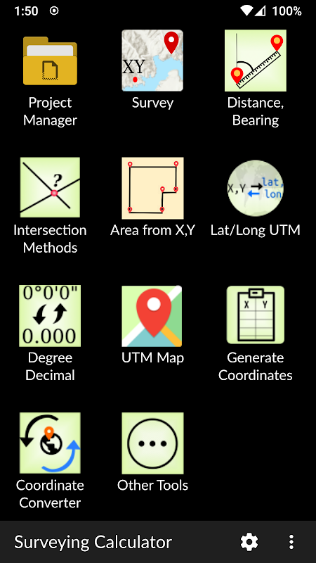
- Jobs:
→ Create unlimited jobs for collecting points in SHP or GeoPackage formats with coordinate system code (EPSG code).
→ You can also prepare a job in QGIS on desktop with geospatial data. Import CAD, GIS, raster data or add online map services in QGIS. And transfer the data folder to Surveying_Calculator/projects folder on your device. Select the project in Jobs and Start Survey.
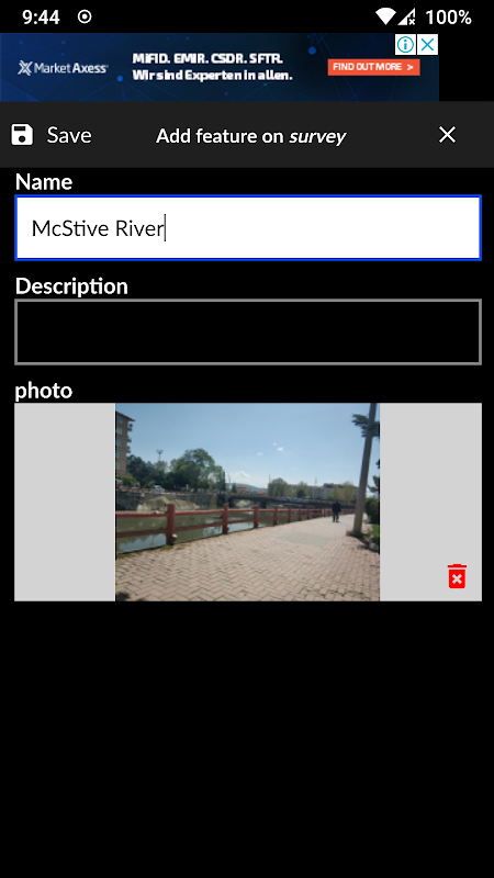
- Start Survey:
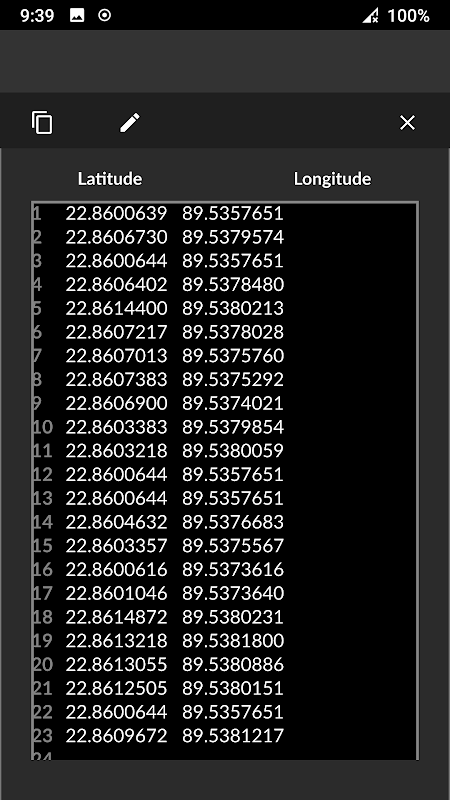
→ Collect unlimited points with "name" and "description". You can record your location or any place you want.
→ Add point with coordinates ( x, y or latitude, longitude).
→ Make surveying easy using QGIS projects.
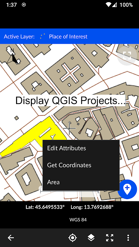
- Map Viewer: Displays QGIS 3 projects.
→ It is possible to include geospatial data to display maps on this app;
→ Raster (GeoTIFF, DEM, JPEG, PNG, GRD, XYZ, ..),
→ CAD (DXF, DGN v7),
→ GIS (ArcGIS shp, Google Earth (kml, kmz), GeoJSON, GPX..),
→ Online map services (Open Street Maps, Hybrid Maps, Satellite Maps, Terrain Maps..) Online maps can be prepared using QuickMapServices plugin in QGIS. You can add Open Street Maps, hybrid or satellite maps in QGIS project for Surveying Calculator.
→ Geodatabase (GeoPackage, Spatialite) formats in QGIS projects.
- Coordinate System support:
→ Supports 5000 different EPSG coordinate systems.
→ User can search a coordinate system with country name or coordinate system name on epsg.io site. And user can create jobs with a proper EPSG code.
→ The coordinate system can be projected ( in feet or meters units) or geographic (in degree)
- Generate Coordinates: Generate coordinates in latitude/ longitude or in X, Y.
- Basic Surveying Tools: X(N), Y(E) Calculation, Distance, Azimuth Calculation, Interior Angle, Latitude Longitude from point, distance and bearing
- Intersection Methods: Forward Intersection, Line - Line Intersection, Circle by 3 Points
- Distance between Coordinates: 2D, 3D distance from X, Y and distance from Latitude, Longitude
- Area calculation from coordinates
- Degree - Decimal Conversion
- Coordinate Converter: WGS84 Latitude/Longitude to UTM XY or UTM XY to Latitude/Longitude Conventer, 2D Helmert transformation
- Settings: Coordinate order of northing, easting or latitude, longitude. DMS or decimal options for geographic coordinate systems. Scale bar unit settings in metric or imperial.
- and more.
Surveying Calculator supports Android 6.0 and up. Minimum 2GB RAM with 300MB free space are recommended.
Some of the new modules have bugs with the new update:
- Start Survey: The app sometimes closes unexpectedly when GPS button is active. To prevent this problem, turn off GPS mode before exiting Start Survey.
- Scale bar sometimes gives wrong results after adding layers and storing points.
- Projects sometimes display rotated map on Start Survey and Map View.
- Points are sometimes not recorded in Geopackage format.
It is planned to fix the weird bugs for next updates.
If you need help or if you have any suggestion about this app please mail to [email protected] or join Surveying Calculator Facebook group to ask questions. You can follow news about the app on Facebook Page:
fb.me/surveyingcalculator
Surveying Calculator ha comunemente utilizzato strumenti di rilevamento del territorio. Ciò include i calcoli della geometria delle coordinate, la raccolta dei dati dei punti offline, la visualizzazione di CAD, GIS, dati raster e mappe online nel formato del progetto QGIS 3. Surveying Calculator supporta progetti QGIS 3. (qgs, qgz)
Caratteristiche :
- Jobs:
& Rarr; Crea lavori illimitati per la raccolta di punti nei formati SHP o GeoPackage con codice di sistema di coordinate (codice EPSG).
& Rarr; Puoi anche preparare un lavoro in QGIS sul desktop con dati geospaziali. Importa CAD, GIS, dati raster o aggiungi servizi di mappe online in QGIS. E trasferisci la cartella dei dati nella cartella Surveying_Calculator / progetti sul tuo dispositivo. Seleziona il progetto in Jobs and Start Survey.
- Avvia sondaggio:
& Rarr; Raccogliere punti illimitati con "nome" e "descrizione". Puoi registrare la tua posizione o qualsiasi luogo tu voglia.
& Rarr; Aggiungi punto con coordinate (x, y o latitudine, longitudine).
& Rarr; Semplifica il rilevamento utilizzando i progetti QGIS.
- Visualizzatore mappe: Visualizza i progetti QGIS 3.
& Rarr; È possibile includere dati geospaziali per visualizzare mappe su questa app;
& Rarr; Raster (GeoTIFF, DEM, JPEG, PNG, GRD, XYZ, ..),
& Rarr; CAD (DXF, DGN v7),
& Rarr; GIS (ArcGIS shp, Google Earth (kml, kmz), GeoJSON, GPX ..),
& Rarr; Servizi di mappe online (Open Street Maps, Hybrid Maps, Satellite Maps, Terrain Maps ...) Le mappe online possono essere preparate usando il plugin QuickMapServices in QGIS. Puoi aggiungere Open Street Maps, mappe ibride o satellitari nel progetto QGIS per Surveying Calculator.
& Rarr; Formati di geodatabase (GeoPackage, Spatialite) nei progetti QGIS.
- Supporto del sistema di coordinate:
& Rarr; Supporta 5000 diversi sistemi di coordinate EPSG.
& Rarr; L'utente può cercare un sistema di coordinate con il nome del paese o il nome del sistema di coordinate sul sito epsg.io. E l'utente può creare lavori con un codice EPSG adeguato.
& Rarr; Il sistema di coordinate può essere proiettato (in unità di piedi o metri) o geografico (in gradi)
- Genera coordinate: Genera coordinate in latitudine / longitudine o in X, Y.
- Strumenti topografici: X (N), Y (E) Calcolo, Distanza, Calcolo azimutale, Angolo interno, Latitudine Longitudine da punto, distanza e rilevamento
- Metodi di intersezione: Intersezione in avanti, Linea - Intersezione di linea, Cerchio di 3 punti
- Distanza tra coordinate: 2D, 3D distanza da X, Y e distanza da Latitudine, Longitudine
- Calcolo area da coordinate
- Laurea - Conversione decimale
- Convertitore di coordinate: WGS84 Latitude / Longitude to UTM XY o UTM XY to Latitude / Longitude Conventer, trasformazione 2D Helmert
- Impostazioni : Ordine coordinato di nord, est o latitudine, longitudine. DMS o opzioni decimali per i sistemi di coordinate geografiche. Impostazioni dell'unità della barra di scala in metrica o imperiale.
- e altro.
Surveying Calculator supporta Android 6.0 e versioni successive. Si raccomandano almeno 2 GB di RAM con 300 MB di spazio libero.
Alcuni dei nuovi moduli hanno dei bug con il nuovo aggiornamento:
- Avvia sondaggio: l'app a volte si chiude inaspettatamente quando il pulsante GPS è attivo. Per evitare questo problema, disattivare la modalità GPS prima di uscire da Avvia sondaggio.
- La barra della scala a volte fornisce risultati errati dopo l'aggiunta di livelli e la memorizzazione di punti.
- I progetti a volte visualizzano la mappa ruotata su Start Survey e Map View.
- I punti a volte non sono registrati nel formato Geopackage.
Si prevede di correggere gli strani bug per i prossimi aggiornamenti.
Se hai bisogno di aiuto o se hai qualche suggerimento su questa app, invia una mail a [email protected] o unisciti al gruppo Facebook Surveying Calculator per porre domande. Puoi seguire le notizie sull'app sulla pagina Facebook:
fb.me/surveyingcalculator
What's New
- Added Jobs, Start Survey, Map View and Coordinate Generator modules.
- Able to add jobs in SHP or GeoPackage formats
- Able to store unlimited points in SHP or GeoPackage formats. Almost all coordinate systems supported in the world (5000+ EPSG coordinate systems support)
- Support for displaying the formats: Rasters (GeoTIFF, DEM, JPEG, E00, GRD...), CAD (DXF, DGN), GIS (SHP, KML, KMZ, GML, GPX, GeoJSON...), and Geospatial database (GeoPackage, Spatialite)
- Updated Settings
Latest Version (Download)
Surveying Calculator 3.5.4Date Updated : 2023-01-17
Advertisement
