Advertisement
Latest Version (Download)Table of Contents
Advertisement
Information
| Package | org.project.geoclass |
| Version | 3.5.4 |
| Date Updated | 2023-01-17 |
| Size | 51.89 MB |
| Installs | 44 |
| Categories | Aplikasi, Peralatan |
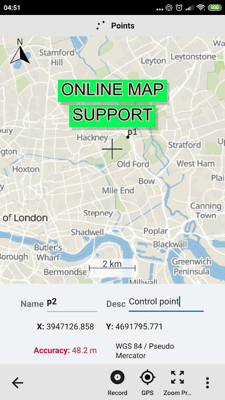
Screenshots


Description
Aplikasi survei tanah praktis.
Surveying Calculator has commonly used land surveying tools. This includes coordinate geometry calculations, offline point data collection, displaying CAD, GIS, raster data and online maps in QGIS 3 project format. Surveying Calculator supports QGIS 3 projects. (qgs, qgz)
Features:
- Jobs:
→ Create unlimited jobs for collecting points in SHP or GeoPackage formats with coordinate system code (EPSG code).
→ You can also prepare a job in QGIS on desktop with geospatial data. Import CAD, GIS, raster data or add online map services in QGIS. And transfer the data folder to Surveying_Calculator/projects folder on your device. Select the project in Jobs and Start Survey.
- Start Survey:
→ Collect unlimited points with "name" and "description". You can record your location or any place you want.
→ Add point with coordinates ( x, y or latitude, longitude).
→ Make surveying easy using QGIS projects.
- Map Viewer: Displays QGIS 3 projects.
→ It is possible to include geospatial data to display maps on this app;
→ Raster (GeoTIFF, DEM, JPEG, PNG, GRD, XYZ, ..),
→ CAD (DXF, DGN v7),
→ GIS (ArcGIS shp, Google Earth (kml, kmz), GeoJSON, GPX..),
→ Online map services (Open Street Maps, Hybrid Maps, Satellite Maps, Terrain Maps..) Online maps can be prepared using QuickMapServices plugin in QGIS. You can add Open Street Maps, hybrid or satellite maps in QGIS project for Surveying Calculator.
→ Geodatabase (GeoPackage, Spatialite) formats in QGIS projects.
- Coordinate System support:
→ Supports 5000 different EPSG coordinate systems.
→ User can search a coordinate system with country name or coordinate system name on epsg.io site. And user can create jobs with a proper EPSG code.
→ The coordinate system can be projected ( in feet or meters units) or geographic (in degree)
- Generate Coordinates: Generate coordinates in latitude/ longitude or in X, Y.
- Basic Surveying Tools: X(N), Y(E) Calculation, Distance, Azimuth Calculation, Interior Angle, Latitude Longitude from point, distance and bearing
- Intersection Methods: Forward Intersection, Line - Line Intersection, Circle by 3 Points
- Distance between Coordinates: 2D, 3D distance from X, Y and distance from Latitude, Longitude
- Area calculation from coordinates
- Degree - Decimal Conversion
- Coordinate Converter: WGS84 Latitude/Longitude to UTM XY or UTM XY to Latitude/Longitude Conventer, 2D Helmert transformation
- Settings: Coordinate order of northing, easting or latitude, longitude. DMS or decimal options for geographic coordinate systems. Scale bar unit settings in metric or imperial.
- and more.
Surveying Calculator supports Android 6.0 and up. Minimum 2GB RAM with 300MB free space are recommended.
Some of the new modules have bugs with the new update:
- Start Survey: The app sometimes closes unexpectedly when GPS button is active. To prevent this problem, turn off GPS mode before exiting Start Survey.
- Scale bar sometimes gives wrong results after adding layers and storing points.
- Projects sometimes display rotated map on Start Survey and Map View.
- Points are sometimes not recorded in Geopackage format.
It is planned to fix the weird bugs for next updates.
If you need help or if you have any suggestion about this app please mail to [email protected] or join Surveying Calculator Facebook group to ask questions. You can follow news about the app on Facebook Page:
fb.me/surveyingcalculator
Survei Survei Kalkulator umumnya menggunakan alat survei tanah. Ini termasuk perhitungan geometri koordinat, pengumpulan data titik offline, menampilkan CAD, GIS, data raster dan peta online dalam format proyek QGIS 3. Survei Survei Kalkulator mendukung proyek QGIS 3. (qgs, qgz)
Fitur :
- Pekerjaan :
& rarr; Buat pekerjaan tanpa batas untuk mengumpulkan poin dalam format SHP atau GeoPackage dengan kode sistem koordinat (kode EPSG).
& rarr; Anda juga dapat menyiapkan pekerjaan di QGIS di desktop dengan data geospasial. Impor CAD, GIS, data raster, atau tambahkan layanan peta online di QGIS. Dan transfer folder data ke folder Surveying_Calculator / proyek pada perangkat Anda. Pilih proyek di Pekerjaan dan Mulai Survei.
- Mulai Survei:
& rarr; Kumpulkan poin tanpa batas dengan "nama" dan "deskripsi". Anda dapat merekam lokasi Anda atau tempat mana pun yang Anda inginkan.
& rarr; Tambahkan titik dengan koordinat (x, y atau lintang, bujur).
& rarr; Jadikan survei mudah menggunakan proyek QGIS.
- Penampil Peta: Menampilkan proyek QGIS 3.
& rarr; Dimungkinkan untuk memasukkan data geospasial untuk menampilkan peta pada aplikasi ini;
& rarr; Raster (GeoTIFF, DEM, JPEG, PNG, GRD, XYZ, ..),
& rarr; CAD (DXF, DGN v7),
& rarr; GIS (ArcGIS shp, Google Earth (kml, kmz), GeoJSON, GPX ..),
& rarr; Layanan peta online (Open Street Maps, Hybrid Map, Satellite Map, Terrain Maps ..) Peta online dapat disiapkan menggunakan plugin QuickMapServices di QGIS. Anda dapat menambahkan Open Street Maps, hybrid, atau satelit di proyek QGIS untuk Surveying Calculator.
& rarr; Format Geodatabase (GeoPackage, Spatialite) dalam proyek QGIS.
- Dukungan Sistem Koordinasi:
& rarr; Mendukung 5000 sistem koordinat EPSG yang berbeda.
& rarr; Pengguna dapat mencari sistem koordinat dengan nama negara atau mengoordinasikan nama sistem di situs epsg.io. Dan pengguna dapat menciptakan pekerjaan dengan kode EPSG yang tepat.
& rarr; Sistem koordinat dapat diproyeksikan (dalam satuan kaki atau meter) atau geografis (dalam derajat)
- Hasilkan Koordinat: Hasilkan koordinat di lintang / bujur atau X, Y.
- Alat Survei Dasar: Perhitungan X (N), Y (E), Jarak, Perhitungan Azimuth, Sudut Interior, Garis Bujur Lintang dari titik, jarak, dan bantalan
- Metode titik-temu: Maju titik-temu, Garis - Garis temu, Lingkari dengan 3 Poin
- Jarak antar Koordinat: 2D, jarak 3D dari X, Y dan jarak dari Latitude, Longitude
- Penghitungan area dari koordinat
- Gelar - Konversi Desimal
- Konverter Koordinat: WGS84 Latitude / Longitude ke UTM XY atau UTM XY ke Latitude / Longitude Conventer, transformasi Helmert 2D
- Pengaturan : Koordinasikan urutan utara, timur atau lintang, bujur. Opsi DMS atau desimal untuk sistem koordinat geografis. Pengaturan satuan batang skala dalam metrik atau imperial.
- dan lainnya.
Survei Survei mendukung Android 6.0 dan lebih tinggi. Disarankan minimal 2GB RAM dengan 300MB ruang kosong.
Beberapa modul baru memiliki bug dengan pembaruan baru:
- Mulai Survei: Aplikasi kadang-kadang menutup secara tak terduga ketika tombol GPS aktif. Untuk mencegah masalah ini, matikan mode GPS sebelum keluar dari Start Survey.
- Bar Skala kadang memberikan hasil yang salah setelah menambahkan lapisan dan menyimpan poin.
- Proyek terkadang menampilkan peta yang dirotasi pada Mulai Survei dan Tampilan Peta.
- Poin terkadang tidak direkam dalam format Geopackage.
Direncanakan untuk memperbaiki bug aneh untuk pembaruan selanjutnya.
Jika Anda memerlukan bantuan atau jika Anda memiliki saran tentang aplikasi ini, silakan kirim email ke [email protected] atau bergabung dengan grup Facebook Surveying Calculator untuk mengajukan pertanyaan. Anda dapat mengikuti berita tentang aplikasi di Halaman Facebook:
fb.me/surveyingcalculator
What's New
- Added Jobs, Start Survey, Map View and Coordinate Generator modules.
- Able to add jobs in SHP or GeoPackage formats
- Able to store unlimited points in SHP or GeoPackage formats. Almost all coordinate systems supported in the world (5000+ EPSG coordinate systems support)
- Support for displaying the formats: Rasters (GeoTIFF, DEM, JPEG, E00, GRD...), CAD (DXF, DGN), GIS (SHP, KML, KMZ, GML, GPX, GeoJSON...), and Geospatial database (GeoPackage, Spatialite)
- Updated Settings
Latest Version (Download)
Surveying Calculator 3.5.4Date Updated : 2023-01-17
Advertisement
