Advertisement
Latest Version (Download)Table of Contents
Advertisement
Information
| Package | com.peaklens.ar |
| Version | 1.1.17 |
| Date Updated | 2021-12-29 |
| Size | 34.35 MB |
| Installs | 911 |
| Categories | , |
Screenshots


Description
aplikasi augmented reality untuk tepat pengakuan puncak gunung secara online dan offline
PeakLens will transform your mountain activity into an amazing experience, allowing you to get a deeper knowledge of the mountains and to create stunning photos enriched with the most accurate information about the peaks in view.
Discover the names and locations of mountain and hills around you while hiking, climbing, skiing, trekking or enjoying your favorite outdoor activity. Test your mountain knowledge and share your pictures of stunning skyline views with your friends on social networks.
FEATURES
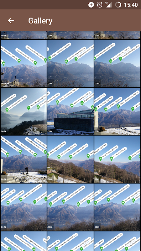
- Precisely identifies mountain peaks and hills in real-time.
- Works worldwide: from Alps, Himalayas, Rocky Mountains and Andes up to the smallest hills, anywhere on Earth.
- Corrects GPS, compass, magnetometer and gyroscope errors with artificial intelligence.
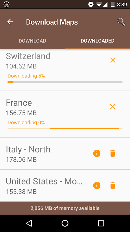
- Works online and offline with pre-downloaded maps.
- High quality photographs with peak names in overlay.
- Knows position, height and distance from you of more than 200.000 peaks.
- Works both with Imperial and Metric unit systems.
PeakLens is a novel Augmented Reality and Virtual Reality app for mountain lovers, hikers and trekkers. It is the result of years of research in artificial intelligence and computer vision, based on a novel algorithm that identifies mountain peaks in real time with high precision. Its core is a software component that compares what you actually see in the camera of your mobile phone or tablet with a virtual panorama, created from a digital 3D landscape model of the Earth. By matching what you see and the virtual panorama, PeakLens automatically corrects most errors that come from the imprecision of the compass and GPS sensor, giving you always the most accurate peak positioning.
RESOURCES
- Digital Elevation Model: the digital elevation model of the SRTM project (https://www2.jpl.nasa.gov/srtm) is used for calculating panoramic views.
- Peaks: the Peaks dataset is extracted from Openstreetmap.com.
OpenStreetMap is open data, licensed under the Open Data Commons Open Database License (ODbL).
PeakLens is a research result of Politecnico di Milano, Dipartimento di Elettronica, Informatica e Bioingegneria.
For any comments, questions or feedbacks contact us at [email protected]!
PeakLens akan mengubah aktivitas gunung Anda menjadi pengalaman yang luar biasa, yang memungkinkan Anda untuk mendapatkan pengetahuan yang lebih dalam pegunungan dan untuk membuat foto yang menakjubkan diperkaya dengan informasi yang paling akurat tentang puncak dalam pandangan.
Temukan nama dan lokasi gunung dan bukit-bukit di sekitar Anda saat hiking, mendaki, ski, trekking atau menikmati aktivitas luar ruangan favorit Anda. Uji pengetahuan gunung Anda dan berbagi foto dari pemandangan cakrawala yang menakjubkan dengan teman-teman Anda di jaringan sosial.
FITUR
- Tepatnya mengidentifikasi puncak gunung dan bukit-bukit secara real-time.
- Bekerja di seluruh dunia: dari Pegunungan Alpen, Himalaya, Rocky Mountains dan Andes ke bukit terkecil, di mana saja di Bumi.
- Mengoreksi GPS, kompas, magnetometer dan giroskop kesalahan dengan kecerdasan buatan.
- Bekerja secara online dan offline dengan peta pra-download.
- foto berkualitas tinggi dengan nama-nama puncak di overlay.
- Tahu posisi, ketinggian dan jarak dari Anda lebih dari 200.000 puncak.
- Bekerja baik dengan sistem satuan Imperial dan Metric.
PeakLens adalah Augmented Reality novel dan aplikasi Virtual Reality bagi pecinta gunung, pejalan kaki dan trekker. Ini adalah hasil dari tahun penelitian dalam kecerdasan dan komputer buatan visi, didasarkan pada algoritma baru yang mengidentifikasi puncak gunung secara real time dengan presisi tinggi. intinya adalah komponen perangkat lunak yang membandingkan apa yang sebenarnya Anda lihat di kamera ponsel atau tablet dengan panorama virtual, dibuat dari model lanskap 3D digital dari Bumi. Dengan mencocokkan apa yang Anda lihat dan panorama virtual, PeakLens otomatis mengoreksi kesalahan yang paling yang datang dari ketidaktepatan dari kompas dan GPS sensor, memberikan Anda selalu puncak posisi paling akurat.
SUMBER
- Digital Elevation Model: model elevasi digital dari proyek SRTM (https://www2.jpl.nasa.gov/srtm) digunakan untuk menghitung panorama.
- Peaks: puncak dataset diekstrak dari Openstreetmap.com.
OpenStreetMap adalah data yang terbuka, dibawah lisensi Open Data Commons Open Database License (ODbL).
PeakLens merupakan hasil penelitian dari Politecnico di Milano, Dipartimento di Elettronica, Informatica e Bioingegneria.
Untuk komentar, pertanyaan atau masukan hubungi kami di [email protected]!
What's New
This version includes some minor bug fixes and x86_64 architecture support
Latest Version (Download)
PeakLens 1.1.17Date Updated : 2021-12-29
Advertisement
