Advertisement
Latest Version (Download)Table of Contents
Advertisement
Information
| Package | com.huntstand.core |
| Version | 5.5 |
| Date Updated | 2021-02-23 |
| Size | 8.71 MB |
| Installs | 1.1K+ |
| Categories | Applications, Sports |
Screenshots
Description
HuntStand, le n ° 1 app de chasse libre dans le monde. Cartographie, Météo, le Scoutisme.
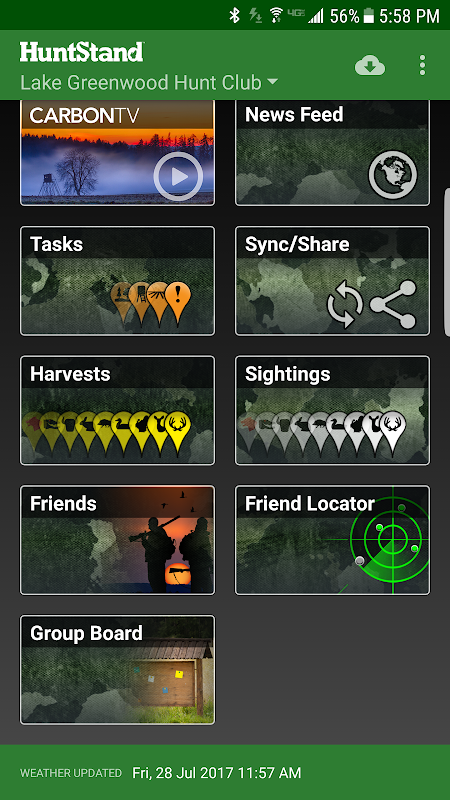
HuntStand, the #1 free hunting app in the world, is the only hunting and land management app you will ever need. This revolutionary app is packed with invaluable mapping, weather, tracking, and social features.
HuntStand was carefully designed to work in both online and offline environments. Using this app, you will have access to offline weather and maps of your hunt areas. You can edit your maps while out “in the field” then sync them with your HuntStand account.
Use our Harvest, Sightings, and Task logging features to understand your property like never before.
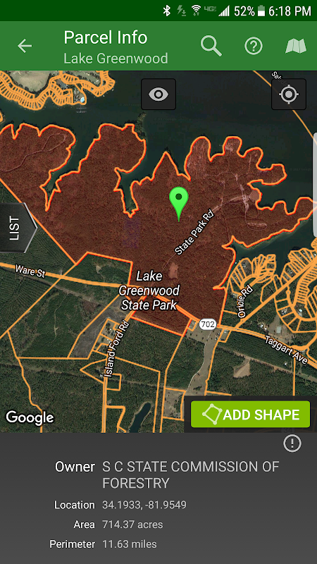
Access free property owner information and parcel boundary information for most of the country.
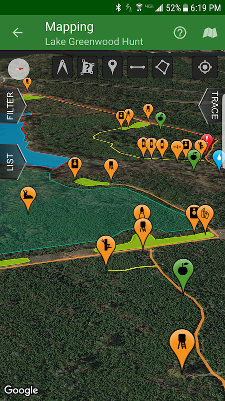
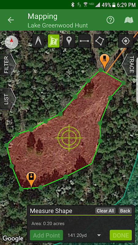
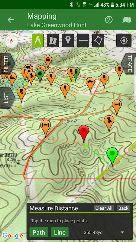
Fully map your property using 67 easily discernible custom icons, shapes, and lines including scouting marks, stands, property boundaries, food plots, ponds, roads, trails, and numerous other important objects of interest. Attach notes to your map objects and sort them by time and type.
View distance and area measurements using our advanced measurement tools. Our app will give you extremely accurate map-based distances in feet, meters, and yards and area measurements in acres.
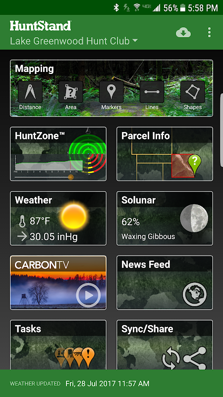
HuntStand's interface is simple, yet powerful, and puts many useful tools right at your fingertips.
Create an account and gain the ability to:
-Sync Hunting Area maps with HuntStand.com
-View and edit maps using ultra-advanced on-line mapping features
-Share maps with friends
-Create a personal profile
-Join group hunting areas (allowing you to share and edit maps with your hunting friends)
-View advanced statistics built from your personal harvest and sighting history
-Sync your maps with other devices (Computers, tablets, phones, including both Android and iOS)
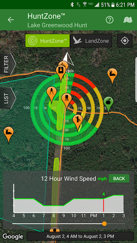
HuntStand features our revolutionary patent pending HuntZone technology. The HuntZone scent tool shows wind speed, direction, distance, and time in the most streamlined and efficient way possible. You can “slide” through wind forecasts and view the effects on your desired hunting area. The HuntZone tracks where your scent will be both at a specific time and throughout your hunt, allowing you to plan accordingly.
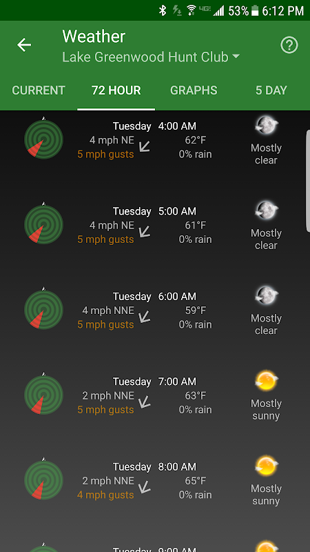
Have access to highly detailed weather and solunar information including a current weather page, (with useful charts) a 72 hour forecast, and a 5 day outlook.
HuntStand, powered by TerraStride, will revolutionize the way people hunt and operate in the outdoors.
HuntStand, le n ° 1 app de chasse libre dans le monde, est la seule chasse et la gestion des terres app vous aurez jamais besoin. Cette application révolutionnaire est emballé avec la cartographie inestimable, la météo, le suivi, et les caractéristiques sociales.
HuntStand a été soigneusement conçu pour fonctionner dans les environnements en ligne et hors ligne. En utilisant cette application, vous aurez accès à la météo et des cartes en mode hors connexion de vos zones de chasse. Vous pouvez modifier vos cartes tout en dehors "dans le champ", puis les synchroniser avec votre compte HuntStand.
Utilisez notre récolte, sur le vif, et la tâche fonctionnalités de journalisation pour comprendre votre propriété comme jamais auparavant.
Accès établissement informations sur le propriétaire et parcelle information de limite pour la plupart des pays.
carte entièrement votre propriété en utilisant 67 facilement discernables des icônes personnalisées, des formes et des lignes, y compris les marques de scoutisme, des stands, des limites de propriété, des parcelles alimentaires, des étangs, des routes, des sentiers, et de nombreux autres objets importants d'intérêt. Joindre des notes à vos objets de la carte et de les trier par le temps et le type.
Voir la distance et les mesures de surface à l'aide de nos outils de mesure avancés. Notre application vous donnera extrêmement précis distances basés sur des cartes en pieds, mètres, et les chantiers et les mesures de surface en acres.
L'interface HuntStand est simple, mais puissant, et met de nombreux outils utiles à portée de main.
Créer un compte et d'acquérir la capacité à:
-sync Zone de chasse des cartes avec HuntStand.com
cartes -Voir et éditer en utilisant ultra-avancée en ligne fonctionnalités de cartographie
cartes -Partager avec des amis
-Créer Un profil personnel
zones de chasse de groupe -join (vous permettant de partager et modifier des cartes avec vos amis de chasse)
statistiques avancées -Voir construites à partir de votre récolte et observation histoire personnelle
-sync Vos cartes avec d'autres appareils (ordinateurs, tablettes, téléphones, y compris à la fois Android et iOS)
HuntStand dispose notre technologie de HuntZone de brevet en instance révolutionnaire. L'outil HuntZone parfum indique la vitesse du vent, la direction, la distance et le temps de la manière la plus simple et efficace possible. Vous pouvez "glisser" grâce à des prévisions de vent et de voir les effets sur votre zone de chasse souhaitée. Le HuntZone suit où votre parfum sera à la fois à un moment précis et tout au long de votre chasse, vous permettant de planifier en conséquence.
Avoir accès à la météo très détaillées et informations solunaire comprenant une page en cours de temps, (avec des graphiques utiles) une prévision de 72 heures, et une perspective de 5 jours.
HuntStand, alimenté par TerraStride, va révolutionner la façon dont les gens la chasse et l'exploitation à l'extérieur.
What's New
- Now targeting Android 8.1
- Added a new Public Lands layer!
- The "Friends" feature has been fixed!
- Check out our new "Land For Sale" feature!
- The HuntZone feature should look pretty sharp now.
- "Show all" and "Hide all" added to the "Filter" available when Mapping for your convenience.
- Print your maps from HuntStand.com using a desktop browser!
- Feel free to write to [email protected] to report bugs and feature requests.
Latest Version (Download)
HuntStand 5.5Date Updated : 2021-02-23
Advertisement
