Advertisement
Latest Version (Download)Table of Contents
Advertisement
Information
| Package | no.avinet.norgeskart |
| Version | 3.16.8 |
| Date Updated | 2021-08-25 |
| Size | 11.23 MB |
| Installs | 827 |
| Categories | , |
Screenshots


Description
Die besten Wanderkarten für Norwegen. TellTur, GodTur, GPS, Routen, Trackaufzeichnung
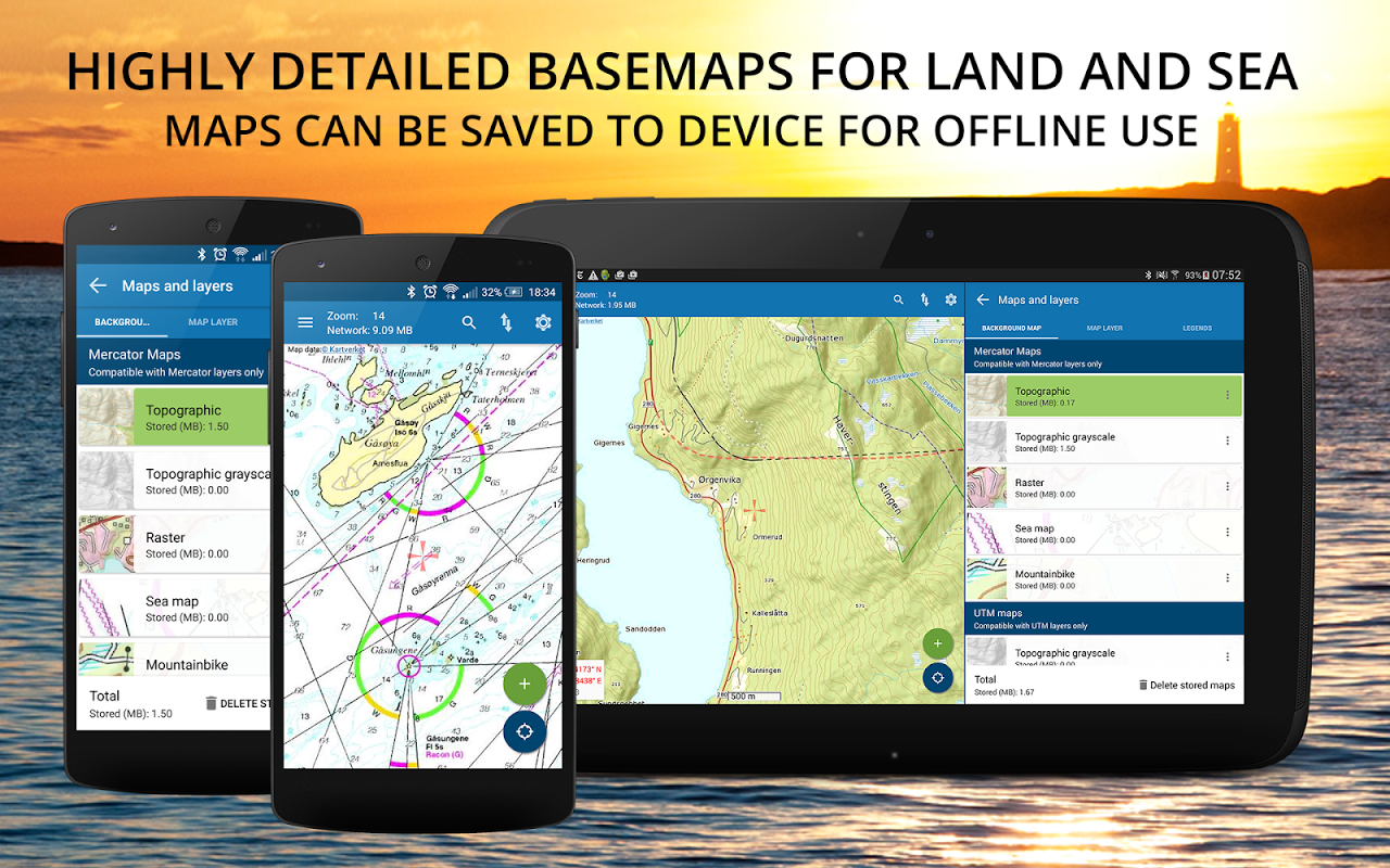
Norgeskart Outdoors has all what you need for hiking, biking, boating or skiing. Everything can be made available for offline use without mobile coverage. Includes topographically maps for Norway, Svalbard, Jan Mayen and Sweden. Now also with altitude (depth at sea) and place name for any given location in Norway!
The app was first launched in 2010 under the name Norgeskart, but changed its name to Norgeskart Outdoors in 2018. It is among the most popular hiking and map apps in Norway. Much has happened since it was first launched and there is still a lot to come!
Plan your next trip by downloading tours and descriptions directly in the app from TellTur and GodTur. Everything available regardless of mobile coverage. For Telltur you can register with the app when you arrive at a destination and compete with others to visit most places. You can easily find current trips by filtering and sorting the list of hiking destinations from your location or center of the screen.
Explore exciting archaeological discoveries, cultural monuments, architecture, stories etc. near where you are. This exciting content is taken from the Norwegian Arts Council's Norvegiana database of cultural data from archives, museums and other cultural institutions.
Register points of interest (POIs), routes and record GPS tracks. These can, if desired, be written to GPX files or uploaded to norgeskart.avinet.no. You can then look at your own data in the browser and easily transfer between phones and tablets. In the app you can also read content from GPX files that you find on ut.no or from other sources.
This app contains both free and paid content (see complete overview below). By paying for a subscription, you support the further development of the app and take full advantage of all the exciting things we have to offer.
Free content:
------------------
- Topographical and nautical maps for Norway, Svalbard and Jan Mayen
- Altitude and place name for crosshair location in Norway.
- Search for addresses, place names and coordinates.
- Property borders and UTM grid layers
- Cultural history content from Norvegiana
- Import and export of GPX files
- GPS track recording displayed with graph display.
- Create own routes and POIs
- Compass
- Driving directions
Premium subscription:
------------------
- Topographically maps of Sweden.
- Download maps for offline use (Sweden limited to storage by panning and zooming)
- Trip suggestions from godtur.no and telltur.no
- Check in TellTur trips upon arrival at destination (free the rest of 2020 due to corona)
- Access to map portal norgeskart.avinet.no
- Upload POIs, tracks and routes
- Synchronize your data across devices
- Mountain bike routes for Scandinavia
- Pistes Alpine and Cross-country for Scandinavia
- Avalanche awareness and steepness
- Weak ice
- Snow depth and skiing conditions
- Snowmobile tracks for Scandinavia
- Sea depths
- Conservation areas
- Clay and radon
- Orienting maps from okartkiosken.no
Dynamic point subscription:
------------------
- Connect to one or more dynamically updated KML files on the internet
- Tested against telespor.no for tracking sheeps
Norgeskart Outdoors bietet alles, was Sie zum Wandern, Radfahren, Bootfahren oder Skifahren benötigen. Alles kann für die Offline-Verwendung ohne mobile Abdeckung zur Verfügung gestellt werden. Enthält topografische Karten für Norwegen, Spitzbergen, Jan Mayen und Schweden. Jetzt auch mit Höhe (Tiefe auf See) und Ortsname für einen bestimmten Ort in Norwegen!
Die App wurde erstmals 2010 unter dem Namen Norgeskart eingeführt, 2018 jedoch in Norgeskart Outdoors umbenannt. Sie gehört zu den beliebtesten Wander- und Karten-Apps in Norwegen. Seit dem ersten Start ist viel passiert und es bleibt noch viel zu tun!
Planen Sie Ihre nächste Reise, indem Sie Touren und Beschreibungen direkt in der App von TellTur und GodTur herunterladen. Alles verfügbar, unabhängig von der Mobilfunkabdeckung. Für Telltur können Sie sich bei der App registrieren, wenn Sie an einem Ziel ankommen, und mit anderen konkurrieren, um die meisten Orte zu besuchen. Sie können aktuelle Reisen leicht finden, indem Sie die Liste der Wanderziele von Ihrem Standort oder der Bildschirmmitte aus filtern und sortieren.
Entdecken Sie aufregende archäologische Entdeckungen, Kulturdenkmäler, Architektur, Geschichten usw. in Ihrer Nähe. Dieser aufregende Inhalt stammt aus der Norvegiana-Datenbank des Norwegian Arts Council mit Kulturdaten aus Archiven, Museen und anderen Kulturinstitutionen.
Registrieren Sie Sonderziele (POIs), Routen und zeichnen Sie GPS-Tracks auf. Diese können bei Bedarf in GPX-Dateien geschrieben oder auf norgeskart.avinet.no hochgeladen werden. Sie können dann Ihre eigenen Daten im Browser anzeigen und problemlos zwischen Telefonen und Tablets übertragen. In der App können Sie auch Inhalte aus GPX-Dateien lesen, die Sie auf ut.no oder aus anderen Quellen finden.
Diese App enthält sowohl kostenlose als auch kostenpflichtige Inhalte (siehe vollständige Übersicht unten). Indem Sie für ein Abonnement bezahlen, unterstützen Sie die Weiterentwicklung der App und nutzen alle aufregenden Dinge, die wir zu bieten haben.
Kostenlose Inhalte:
------------------ ------------------.
- Topografische und nautische Karten für Norwegen, Spitzbergen und Jan Mayen
- Höhe und Ortsname für Fadenkreuzstandort in Norwegen.
- Suche nach Adressen, Ortsnamen und Koordinaten.
- Eigenschaftsgrenzen und UTM-Rasterebenen
- Kulturgeschichtlicher Inhalt aus Norvegiana
- Import und Export von GPX-Dateien
- GPS-Aufzeichnung mit grafischer Anzeige.
- Erstellen Sie eigene Routen und POIs
- Kompass
- Fahrtrichtung
Premium-Abonnement:
------------------ ------------------.
- Topographische Karten von Schweden.
- Laden Sie Karten für die Offline-Verwendung herunter (Schweden beschränkt sich auf das Speichern durch Schwenken und Zoomen)
- Reisevorschläge von godtur.no und telltur.no
- Check-in-TellTur-Reisen bei Ankunft am Zielort (Rest des Jahres 2020 aufgrund von Korona kostenlos)
- Zugang zum Kartenportal norgeskart.avinet.no
- Laden Sie POIs, Tracks und Routen hoch
- Synchronisieren Sie Ihre Daten geräteübergreifend
- Mountainbike-Strecken für Skandinavien
- Pistes Alpine und Cross-Country für Skandinavien
- Lawinenbewusstsein und Steilheit
- Schwaches Eis
- Schneehöhe und Skibedingungen
- Schneemobilstrecken für Skandinavien
- Meerestiefen
- Naturschutzgebiete
- Ton und Radon
- Orientierungskarten von okartkiosken.no
Dynamisches Punktabonnement:
------------------ ------------------.
- Stellen Sie eine Verbindung zu einer oder mehreren dynamisch aktualisierten KML-Dateien im Internet her
- Getestet gegen telespor.no zur Verfolgung von Schafen
What's New
3.12.5
- Improved TellTur check in when no mobile coverage
- Fixed download of tiles stopping if network issues.
- Fixed crash in TellTur functions after download
3.12.x:
- TellTur free the rest of 2020 due to corona
- Search for UTM and MGRS added
- Improved quality of map display
- Altitude and place name for location of crosshair
- Added coordinate search
- Added TellTur parkings
- TellTur content refreshed daily in list
- Svalbard maps made available for free online
Latest Version (Download)
Norgeskart Outdoors - Offline maps & trips Norway 3.16.8Date Updated : 2021-08-25
Advertisement
