Advertisement
احدث اصدارجدول المحتويات
Advertisement
المعلومات
| Package | com.basevelocity.radarscope |
| الاصدار | 1.2.1 |
| تاريخ التحديث | 2021-03-12 |
| الحجم | 4.84 MB |
| التحميلات | 17.4K+ |
| الاقسام | تطبيقات, الطقس |
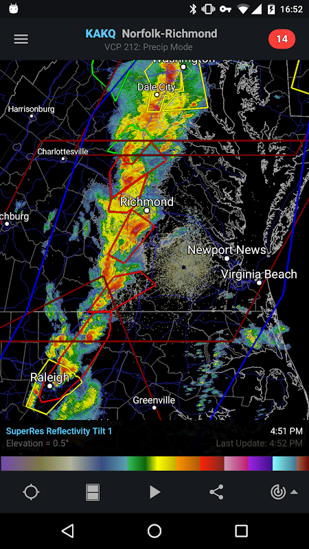
لقطات الشاشة


الوصف
RadarScope يعرض NEXRAD المستوى 3 بيانات الرادار والتحذيرات الجوية القاسية.
RadarScope is a specialized display utility for weather enthusiasts and meteorologists that allows you view NEXRAD Level 3 and Super-Resolution radar data along with Tornado, Severe Thunderstorm, Flash Flood and Special Marine Warnings, and predicted storm tracks issued by the U.S. National Weather Service. It can display the latest reflectivity, velocity, dual-polarization, and other products from any NEXRAD or TDWR radar site in the United States, Guam, Puerto Rico, Korea, and Okinawa, as well as data from Environment Canada and Australian Bureau of Meteorology radars. These aren't smoothed images, this is native radar data rendered in its original radial format for a high level of detail.
Whether you are scanning reflectivity for a mesocyclone's tell-tale hook echo, trying to pinpoint the landfall of a hurricane's eye wall, or looking for small features like velocity couplets in the storm relative radial velocity product, RadarScope gives you the power to view true radial weather radar data.
RadarScope displays tornado, severe thunderstorm, flash flood, and special marine warnings issued by the U.S. National Weather Service. You can browse the list of active warnings, select a warning to view the details, and even zoom to the selected warning on the map.
Pinch or stretch to zoom in and out. Drag your finger around the map to scroll. Tap the radar sweep button in the toolbar to switch radars. Select one of the 289 different radars in the United States, Canada, Australia, Korea, Puerto Rico, Guam, or Okinawa. Plot your current location by tapping the location button and optionally report it to the Spotter Network. Tap the play button to download and animate over recent images. Display the names of over 25,000 cities and towns on the map as you zoom and scroll. Tap and hold the color legend to see the data values.
Meanwhile, RadarScope will retrieve and display updated data automatically and intelligently (approximately every 2 to 10 minutes, depending on the radar scan strategy).
You can display data from NOAA's public access web site, our optional WDT feed (the default), or your AllisonHouse subscriber account. Spotter Network members can report their location and view the locations of other spotters.
You can display radar data from our servers, NOAA's public access web site, or your Allison House subscriber account. Spotter Network members can report their location and view the locations of other spotters.
RadarScope Pro is an optional auto-renewing subscription with two different tiers to choose from.
RadarScope Pro Tier One is an annual subscription that provides access to real-time lightning data in the U.S. and Canada that animates along with the radar loop and up to 30 frames of radar data, including extended loops of super-resolution data. Tier One subscribers can also access a data interrogation tool to quickly determine data values for specific radar pixels and an optional dual-pane mode for viewing two radar products side-by-side.
RadarScope Pro Tier Two is an annual or monthly subscription that combines all the features in Tier One with more advanced features, including SPC outlooks, local storm reports, hail size and probability contours, and azimuthal shear contours in the U.S., a 30-day archive of all radar products, and the ability to use subscription features across multiple platforms.
If you choose to buy the RadarScope Pro subscription, it will be charged to your Google Play account. Subscriptions renew automatically, and you're charged at the beginning of each subscription period. Subscriptions may be managed and auto-renewal disabled via your Google Play app after the purchase.
DTN is committed to safeguarding your privacy online. Our privacy policy is available for review at: https://www.dtn.com/privacy-policy/
Please visit our web site for more information.
RadarScope هي أداة عرض متخصصة لعشاق الطقس وأخصائيي الأرصاد الجوية ، والتي تتيح لك الاطلاع على بيانات الرادار NEXRAD من المستوى 3 والدقة الفائقة إلى جانب Tornado و Severe Thormstorm و Flash Flood و Special Marine Warning ، ومسارات العواصف المتوقعة الصادرة عن خدمة الطقس الوطنية الأمريكية. يمكنه عرض أحدث الانعكاس والسرعة والاستقطاب المزدوج ، وغيرها من المنتجات من أي موقع رادار NEXRAD أو TDWR في الولايات المتحدة وغوام وبورتوريكو وكوريا وأوكيناوا ، بالإضافة إلى بيانات من هيئة البيئة الكندية والمكتب الأسترالي للأرصاد الجوية الرادارات. هذه الصور ليست ملساء ، إنها بيانات رادار أصلية يتم تقديمها بتنسيق شعاعي الأصلي للحصول على مستوى عالٍ من التفاصيل.
سواء أكنت تقوم بمسح الانعكاسية بحثًا عن صدى الخطاف الخاص بتلميذة الأعاصير الوسطى ، أو تحاول تحديد موقع السقوط لجدار عين الإعصار ، أو تبحث عن ميزات صغيرة مثل مقاطع السرعة في منتج السرعة الشعاعية النسبية للعاصفة ، فإن RadarScope يمنحك القدرة على عرض شعاعي حقيقي. بيانات رادار الطقس.
يعرض RadarScope الإعصار ، والعواصف الرعدية الشديدة ، والفيضانات المفاجئة ، والتحذيرات البحرية الخاصة الصادرة عن هيئة الطقس الوطنية الأمريكية. يمكنك تصفح قائمة التحذيرات النشطة ، وتحديد تحذير لعرض التفاصيل ، وحتى تكبير التحذير المحدد على الخريطة.
قرصة أو تمتد للتكبير والتصغير. اسحب إصبعك حول الخريطة للتمرير. اضغط على زر مسح الرادار في شريط الأدوات لتبديل الرادارات. حدد واحدًا من 289 رادارات مختلفة في الولايات المتحدة أو كندا أو أستراليا أو كوريا أو بورتوريكو أو غوام أو أوكيناوا. ارسم موقعك الحالي من خلال النقر على زر الموقع والإبلاغ عنه اختياريًا إلى Spotter Network. اضغط على زر التشغيل لتنزيل وتحريك أكثر من الصور الحديثة. اعرض أسماء أكثر من 25000 مدينة وبلدة على الخريطة أثناء التكبير والتصغير. اضغط مع الاستمرار على وسيلة إيضاح اللون لرؤية قيم البيانات.
وفي الوقت نفسه ، سيقوم RadarScope باسترداد وعرض البيانات المحدثة تلقائيًا وذكاء (تقريبًا كل دقيقتين إلى 10 دقائق ، وفقًا لاستراتيجية مسح الرادار).
يمكنك عرض البيانات من موقع الوصول العمومي لـ NOAA ، أو موجز WDT الاختياري (الافتراضي) ، أو حساب المشترك في AllisonHouse. يمكن لأعضاء شبكة Spotter الإبلاغ عن موقعهم وعرض مواقع المتتبعين الآخرين.
يمكنك عرض بيانات الرادار من خوادمنا ، أو موقع الوصول العمومي الخاص بـ NOAA ، أو حساب المشترك في Allison House. يمكن لأعضاء شبكة Spotter الإبلاغ عن موقعهم وعرض مواقع المتتبعين الآخرين.
RadarScope Pro هو اشتراك اختياري للتجديد التلقائي مع مستويين مختلفين للاختيار من بينها.
RadarScope Pro Tier One هو اشتراك سنوي يوفر إمكانية الوصول إلى بيانات البرق في الوقت الفعلي في الولايات المتحدة وكندا والتي تعمل مع حلقة الرادار وما يصل إلى 30 إطارًا لبيانات الرادار ، بما في ذلك حلقات ممتدة من البيانات فائقة الدقة. يمكن لمشتركي المستوى الأول أيضًا الوصول إلى أداة استجواب البيانات لتحديد قيم البيانات بسرعة لبيكسلات رادار معينة ووضع اختياري مزدوج الجزء لعرض اثنين من منتجات الرادار جنبًا إلى جنب.
يعتبر RadarScope Pro Tier Two اشتراكًا سنويًا أو شهريًا يجمع بين جميع الميزات الموجودة في Tier One مع ميزات أكثر تقدماً ، بما في ذلك توقعات SPC وتقارير العاصفة المحلية وحجم البرد وملامح الاحتمالات وملامح القص السماوية في الولايات المتحدة وأرشيف مدته 30 يومًا جميع منتجات الرادار ، والقدرة على استخدام ميزات الاشتراك عبر منصات متعددة.
إذا اخترت شراء اشتراك RadarScope Pro ، فسيتم خصمه من حسابك على Google Play. يتم تجديد الاشتراكات تلقائيًا ، وستتم محاسبتك في بداية كل فترة اشتراك. يمكن إدارة الاشتراكات وتعطيل التجديد التلقائي عبر تطبيق Google Play بعد الشراء.
تلتزم DTN بحماية خصوصيتك عبر الإنترنت. سياسة الخصوصية الخاصة بنا متاحة للمراجعة على: https://www.dtn.com/privacy-policy/
يرجى زيارة موقعنا على الانترنت لمزيد من المعلومات.
ما الجديد
Features:
• Improved networking performance.
• New color scheme for SPC outlooks.
• More lenient licensing implementation.
• Bug fixes for stability.
احدث اصدار
RadarScope 1.2.1تاريخ التحديث : 2021-03-12
Advertisement
