Advertisement
احدث اصدارجدول المحتويات
Advertisement
المعلومات
| Package | com.visualit.tubeLondonCity |
| الاصدار | 2.7.0 |
| تاريخ التحديث | 2021-05-06 |
| الحجم | 5.64 MB |
| التحميلات | 4.4K+ |
| الاقسام | , |
لقطات الشاشة


الوصف
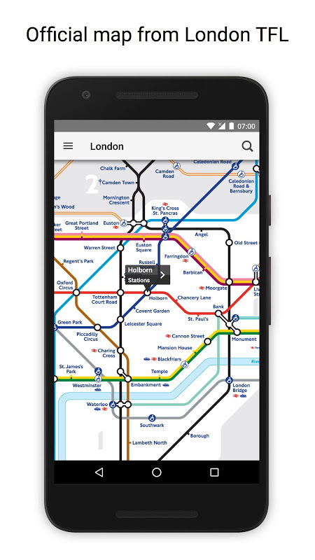
خريطة الأنبوب غير متصل ومسار مخطط مترو أنفاق لندن
● NO INTERNET CONNECTION REQUIRED ●
● Latest official TFL (Transport For London) tube map.
● Instant routing while offline
● Simple, fast and easy to use.
● Designed for the first time visitor and experienced commuter.
● Unique "Minute Map" feature provides a view of travel times from any location on the map.
● Planned route animates on the tube map.
●.Switch to online street map (when an internet connection is available).
● Services can be turned on or off, routing around problems.
● Works in both landscape and portrait modes.
● Easily locates your nearest London transport stop.
● Places of interest, parks etc are built in to the application.
● Offline routing with clear map and text views
● GPS locating
● Station exit information
● Live service status and departure board information
● OVERVIEW ● The London Tube Map application is a superb route planner for the London Underground (Tube)system with many unique features. The inbuilt map provides the official TFL map of the city underground services with the ability to switch to an online street map view when an internet connection is available. This way the user can view the online map feature when above ground and the transport map and route planning is still fully functional underground or anywhere there is no internet connection. This provides the best of both worlds, the transport map and route planning anytime, anywhere and online street maps and search when a connection is available.
● ROUTING ● Does not require an internet connection and will always be available to display a clear and detailed view of the city transport system, plus list and animate the optimum route for your journey. Provides the fastest route calculations of any mobile routing application (virtually instantaneous) using actual published journey times with the ability to select the quickest route or the route with the least changes.
Comprehensive details of your planned route are provided, including changes, directions of travel, number of stops, predicted journey times, etc. Uniquely this application gives you “direction”, “towards” and “service frequency” information (not available on any other offline journey planner) for example “Take the Northern line (Southbound) towards Stockwell for 10 mins (6 stops). Service runs every 7 minutes” which is essential when finding the correct platform and connection. Also given are alternatives for each leg of the journey.
● NO INTERNET CONNECTION REQUIRED ● The tube map and routing do not require an internet connection and therefore you will not be charged data connection fees. This also means the application runs perfectly underground, on an aeroplane, etc. For international visitors to a city who have data roaming turned off this is an ideal solution.
● LIVE INFO ● When an internet connection is available, optional "Live Information" on the current state of the transport services and real time station departure boards can be viewed allowing you to plan your journeys in advance and avoid any potential delays. Unique to this application is the ability to turn off services that are out of action and automatically calculate an alternative route.
● MINUTE MAP ● This unique feature provides a view of travel times from any location on the map. This is helpful for getting a sense of scale and connectivity of the transport system and can provide some interesting results.
● لا يوجد اتصال بالإنترنت مطلوب ●
● أحدث خريطة أنبوب TFL (Transport For London) الرسمي.
● التوجيه الفوري في وضع عدم الاتصال
● بسيطة وسريعة وسهلة الاستخدام.
● صمم لأول مرة زائر وتجربة من ذوي الخبرة.
● ميزة "الخريطة الدقيقة" الفريدة تقدم عرضًا لأوقات السفر من أي مكان على الخريطة.
● يرسم مسار مخطط على خريطة الأنبوب.
● يمكنك التبديل إلى خريطة الشارع عبر الإنترنت (عند توفر اتصال بالإنترنت).
● يمكن تشغيل الخدمات أو إيقافها ، مع التوجيه حول المشكلات.
● يعمل في كل من الوضعين الأفقي والرأسي.
● بسهولة تحديد موقع أقرب محطة النقل الخاصة بك في لندن.
● يتم بناء الأماكن ذات الأهمية ، والمتنزهات وغيرها في التطبيق.
● التوجيه دون اتصال مع عرض خريطة ونص واضح
● تحديد موقع GPS
● معلومات خروج المحطة
● حالة الخدمة المباشرة ومعلومات لوحة المغادرة
● نظرة عامة ● تطبيق London Tube Map عبارة عن مخطط طريق رائع لنظام مترو أنفاق لندن (Tube) مع العديد من الميزات الفريدة. توفر الخريطة المضمنة الخريطة الرسمية TFL لخدمات مترو الأنفاق في المدينة مع القدرة على التحول إلى عرض خريطة الشارع عبر الإنترنت عند توفر اتصال بالإنترنت. وبهذه الطريقة يمكن للمستخدم عرض ميزة الخريطة على الإنترنت عندما يكون فوق سطح الأرض ولا تزال خريطة النقل وتخطيط المسار يعملان بشكل كامل تحت الأرض أو في أي مكان لا يوجد فيه اتصال بالإنترنت. وهذا يوفر أفضل ما في العالمين وخريطة النقل وتخطيط الطريق في أي وقت وفي أي مكان وخرائط الشوارع عبر الإنترنت والبحث عند توفر اتصال.
● اﻟﺗوﺟﯾﮫ ● ﻻ ﯾﺗطﻟب اﺗﺻﺎل إﻧﺗرﻧت وﺳوف ﯾﮐون داﺋﻣًﺎ ﻣﺗﺎﺣًﺎ ﻟﻌرض ﻣﺷﺎھدة واﺿﺣﺔ وﻣﻔﺻﻟﺔ ﻟﻧظﺎم ﻧﻘل اﻟﻣدﯾﻧﺔ ، ﺑﺎﻹﺿﺎﻓﺔ إﻟﯽ ﻗﺎﺋﻣﺔ وﺗﺣرﯾك اﻟﻣﺳﺎر اﻷﻣﺛل ﻟرﺣﻟﺗك. يوفر أسرع حساب للطريق لأي تطبيق توجيه للجوّال (شبه فوري) باستخدام أوقات الرحلات المنشورة الفعلية مع إمكانية تحديد المسار الأسرع أو المسار بأقل التغييرات.
يتم توفير تفاصيل شاملة للطريق المخطط له ، بما في ذلك التغييرات ، واتجاهات السفر ، وعدد محطات التوقف ، وأوقات الرحلات المتوقعة ، وما إلى ذلك. يمنحك هذا التطبيق بشكل فريد معلومات "الاتجاه" و "نحو" و "تردد الخدمة" (غير متوفرة على أي جهاز آخر) مخطط الرحلة دون اتصال بالإنترنت) على سبيل المثال "خذ الخط الشمالي (جنوبًا) نحو Stockwell لمدة 10 دقائق (6 محطات). تعمل الخدمة كل 7 دقائق "وهو أمر ضروري عند العثور على النظام الأساسي والاتصال الصحيحين. كما تقدم بدائل لكل جزء من الرحلة.
● لا يوجد اتصال بالإنترنت مطلوب ● لا تتطلب خريطة الأنبوب والتوجيه اتصالاً بالإنترنت وبالتالي لن تتحمل رسوم اتصال البيانات. ويعني هذا أيضًا أن التطبيق يعمل بشكل مثالي تحت الأرض ، أو على متن طائرة ، إلخ. بالنسبة إلى الزوار العالميين إلى مدينة تم إيقاف تشغيل خدمة التجوال بها ، يعد هذا الحل مثاليًا.
● LIVE INFO ● عندما يتوفر اتصال بالإنترنت ، يمكن عرض "معلومات حية" اختيارية على الحالة الراهنة لخدمات النقل ولوحات مغادرة محطة الوقت الفعلي مما يسمح لك بتخطيط رحلاتك مسبقًا وتجنب أي تأخير محتمل. فريد لهذا التطبيق هو القدرة على إيقاف تشغيل الخدمات التي هي عاطلة عن العمل وحساب مسار بديل تلقائيا.
● MINUTE MAP ● توفر هذه الميزة الفريدة عرضًا لأوقات السفر من أي موقع على الخريطة. هذا مفيد في الحصول على إحساس بالحجم والتوصيل في نظام النقل ويمكن أن يوفر بعض النتائج المثيرة للاهتمام.
ما الجديد
1. Latest map from TFL
2. Routing amends re-opening of Lancaster Gate and Charing Cross Stations
احدث اصدار
Tube Map London Underground 2.7.0تاريخ التحديث : 2021-05-06
Advertisement
